Handheld RTK GNSS Receiver for Surveying – Multi-Frequency GPS/GLONASS/Galileo/BeiDou, Centimeter Accuracy, Integrated Helix Antenna, Wi-Fi/Bluetooth, IP67 Rugged Surveyor, GEODNET RTK Enabled
-
Detail
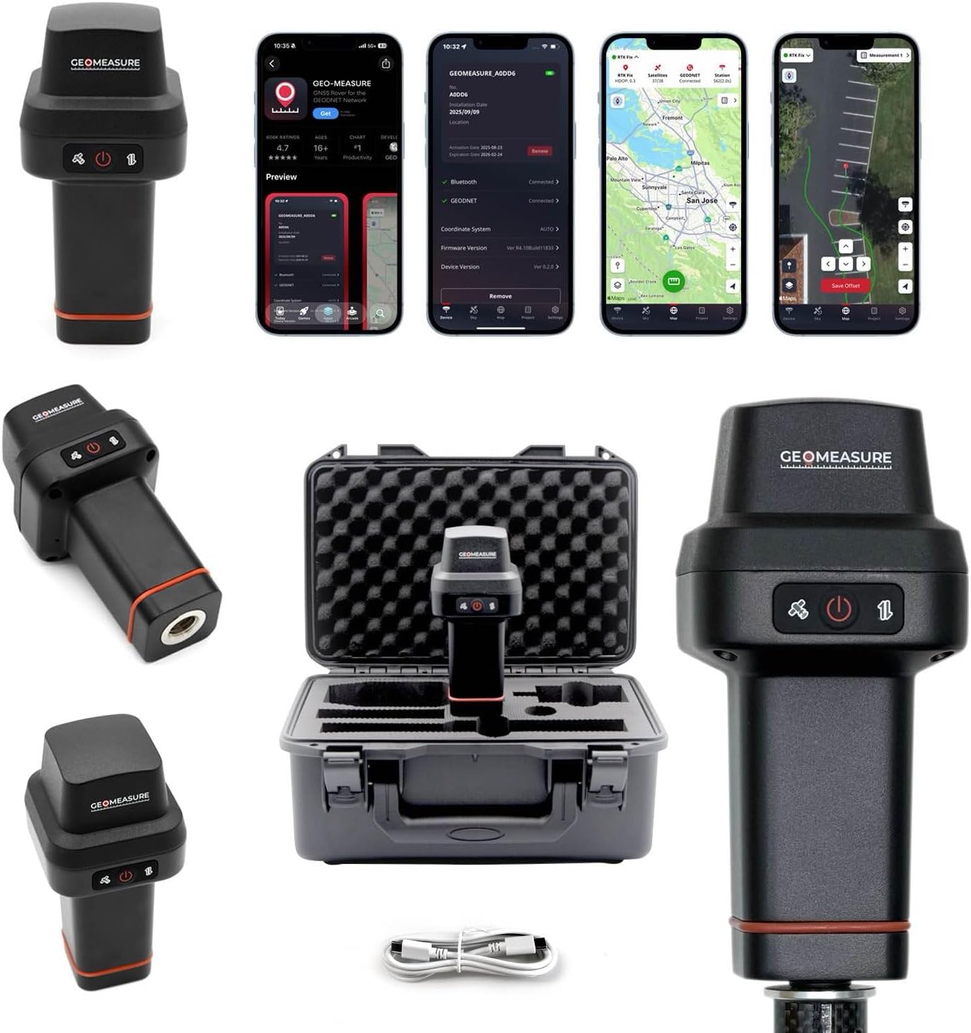
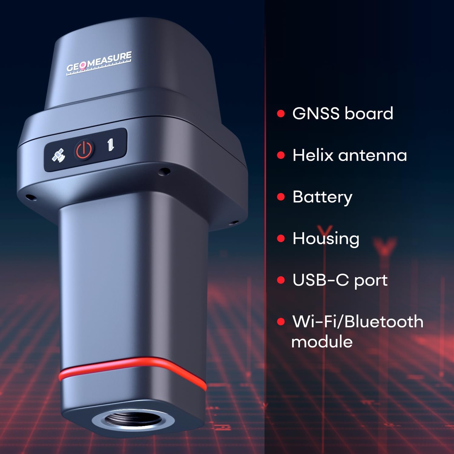
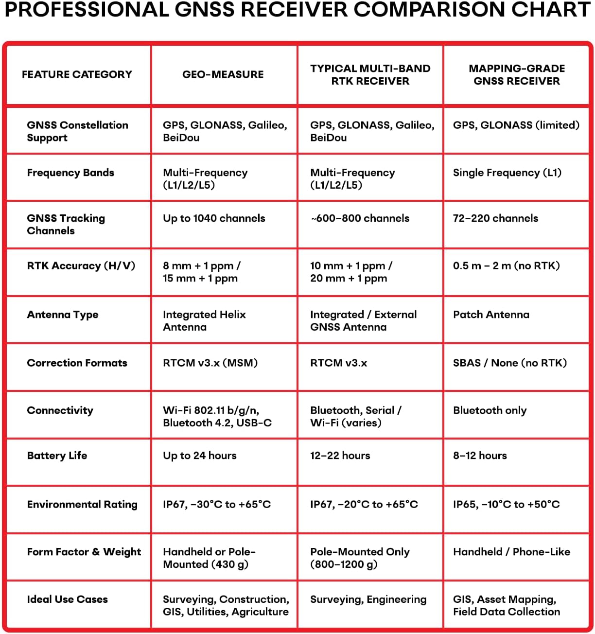
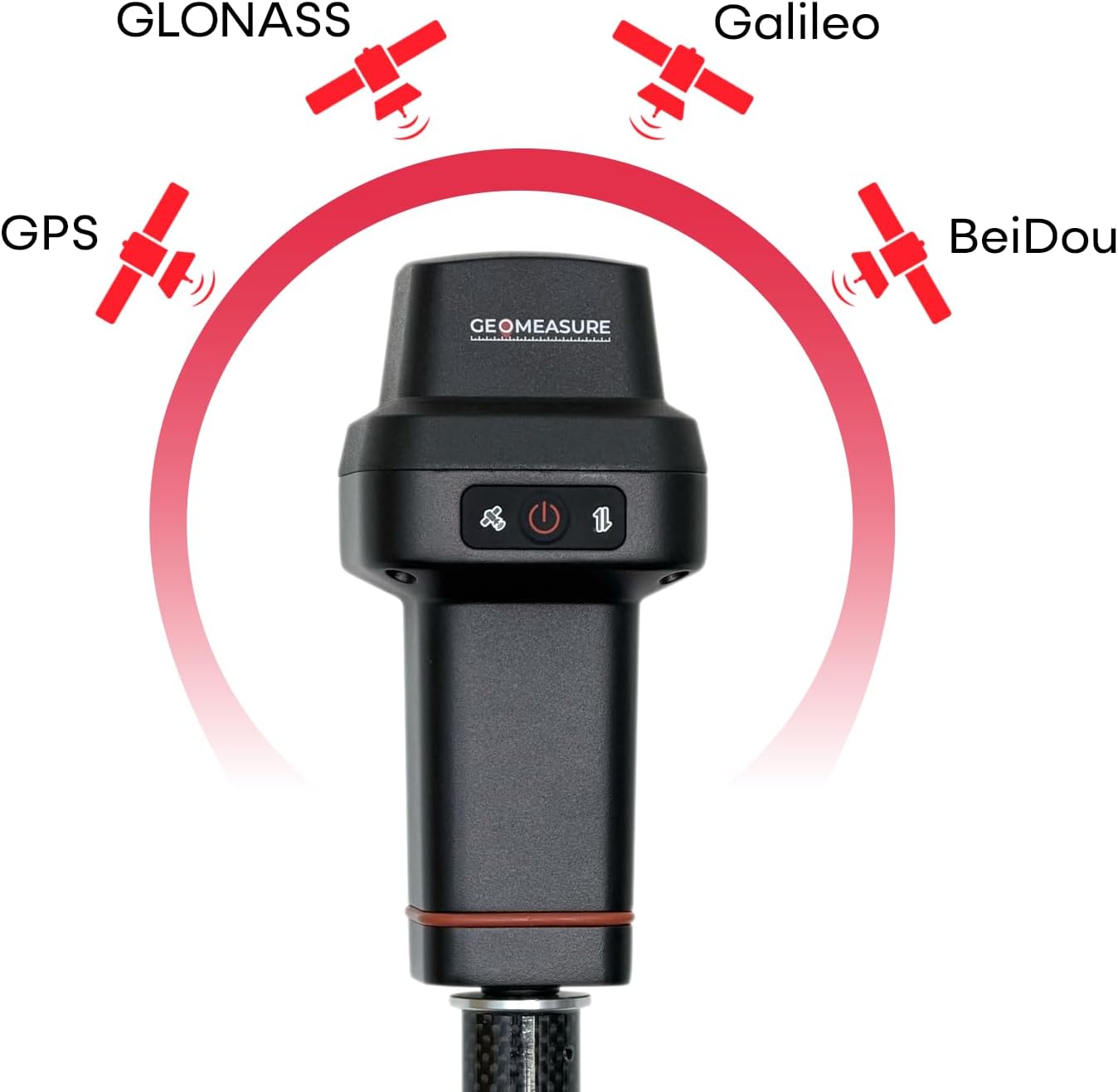
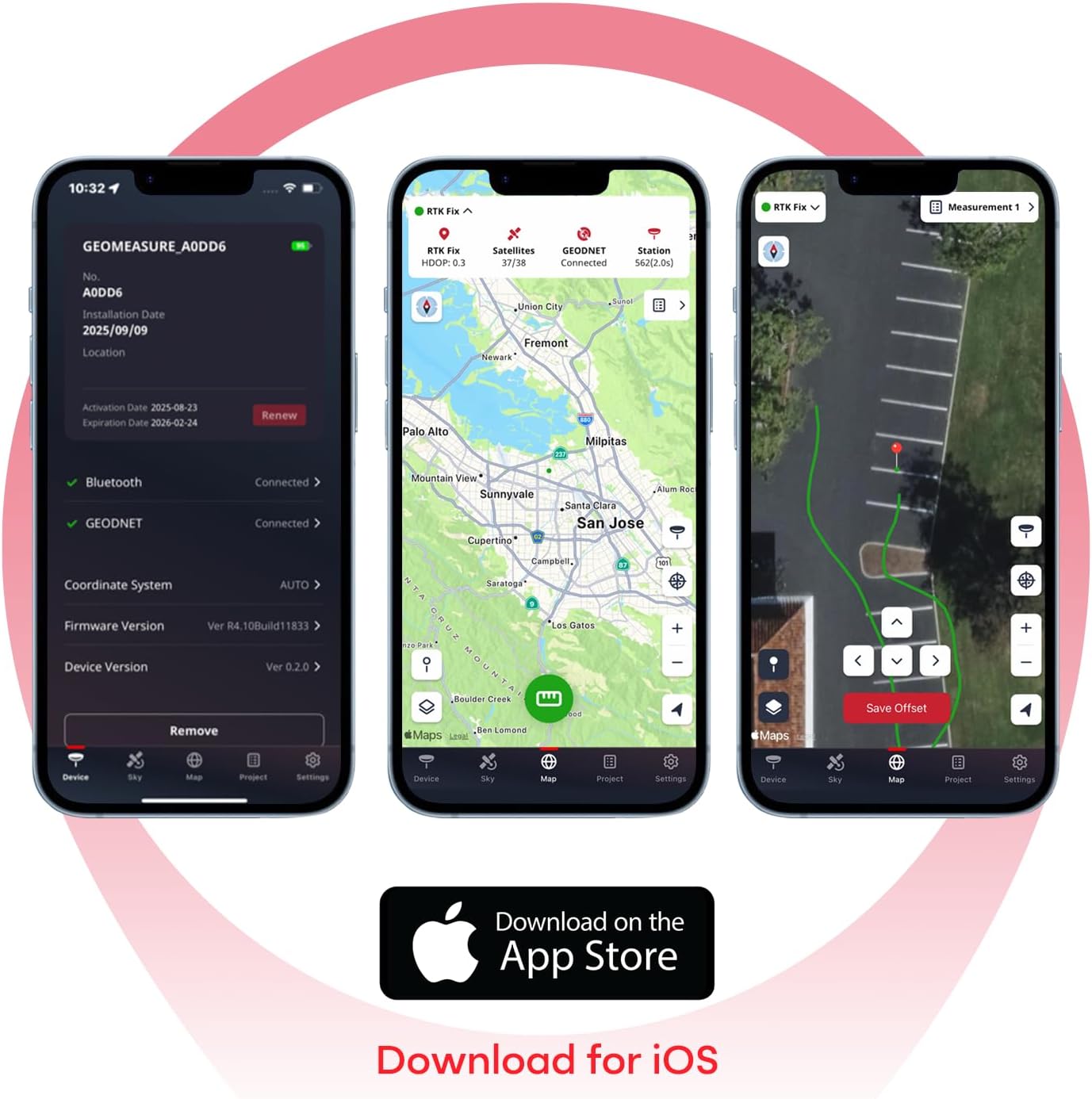
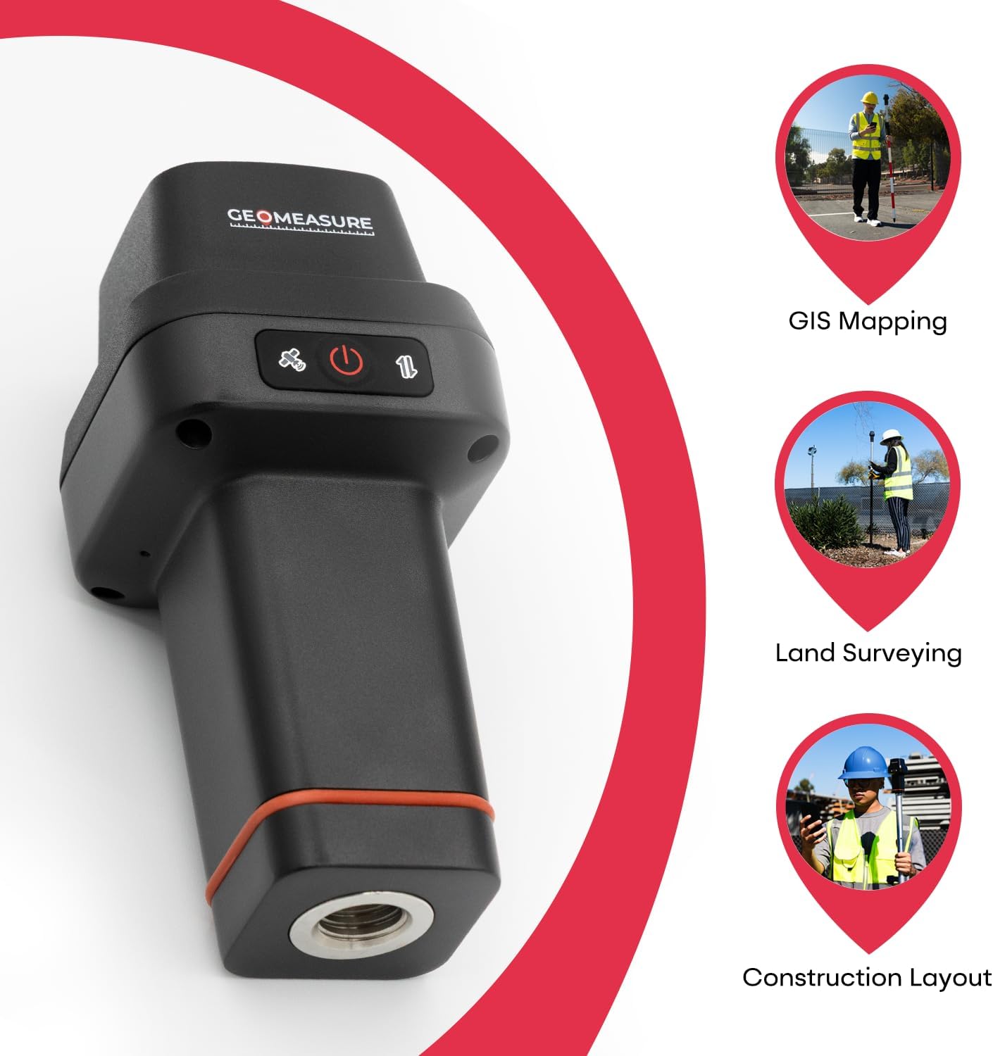
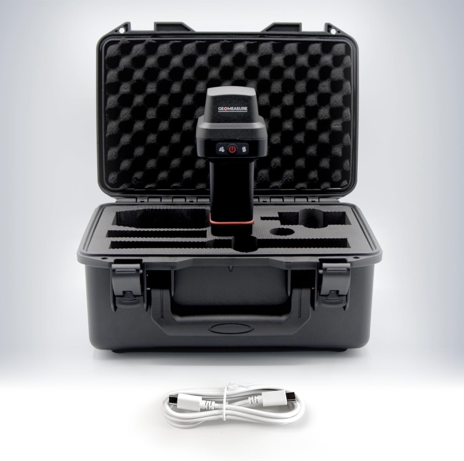
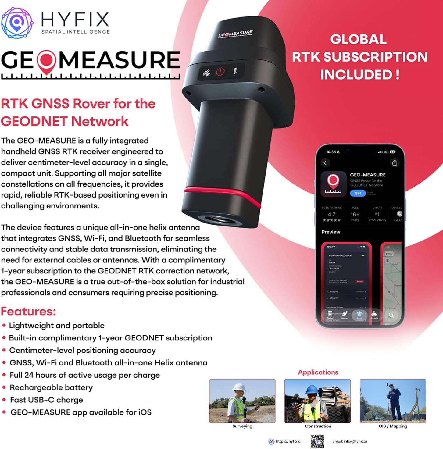
The GEO-MEASURE handheld RTK GNSS receiver is engineered for professional land surveying, construction layout, GIS mapping, and precision measurement tasks requiring dependable, centimeter-level positioning. Leveraging a multi-frequency GNSS architecture, the receiver tracks GPS, GLONASS, Galileo, and BeiDou constellations with up to 1040 channels, maintaining strong satellite geometry and continuous signal availability in open environments, light canopy, and mixed urban conditions. Designed for high-accuracy workflows, the system delivers real-time kinematic (RTK) performance with typical horizontal accuracy of 8 mm + 1 ppm and vertical accuracy of 15 mm + 1 ppm. This supports applications such as boundary surveys, control point establishment, grade checking, construction stakeout, topographic mapping, and geospatial feature collection where consistent positional repeatability is essential. An integrated helix antenna combines GNSS, Wi-Fi, and Bluetooth within a compact form factor, maintaining a stable phase center and consistent signal reception without external antenna components. Multi-frequency tracking improves ambiguity resolution speed, minimizes multipath interference, and enhances initialization reliability across short and medium baselines. These capabilities help maintain RTK FIX status during rover movement and pole-mounted operation. The system pairs with a streamlined mobile app designed to simplify field configuration and data collection. Through the app, users can configure GNSS parameters, access correction services, monitor satellite status, record survey points, perform stakeout operations, manage projects, and export field data. The interface is intuitive for new users while still providing the control expected by experienced survey professionals. Wireless connectivity through Wi-Fi 802.11 b/g/n and Bluetooth 4.2 ensures compatibility with mobile devices, field controllers, and GIS data collection software. A USB-C PD port supports both charging and data transfer. Powered by a 6800 mAh lithium-ion battery, the receiver provides up to 24 hours of continuous GNSS operation, accommodating full-day survey sessions. USB-C PD charging restores power in approximately 4 to 8 hours, enabling practical field-use rotation and efficient battery management during extended deployments. Built for demanding environments, the device features an IP67-rated enclosure to resist dust, water, and impact during field operations. Operating temperatures from –30°C to +65°C support year-round use, while the compact 71 × 71 × 140 mm design and 430 g weight allow handheld use or integration on standard surveying poles and tripods. By combining multi-frequency GNSS performance, durable field construction, extended battery life, and an intuitive app-driven workflow, the GEO-MEASURE supports a broad range of professional applications. For surveying, it provides the centimeter-level RTK accuracy required for boundary, control, and topographic work. In construction layout, its fast initialization and stable tracking assist with stakeout, grade alignment, and onsite positioning. For GIS and mapping, the integrated software tools and long operating duration enable efficient attribute collection and geospatial data capture. Utility and infrastructure teams benefit from reliable positioning for asset verification and inspection, while agricultural users can apply the system’s accuracy for field measurement, equipment positioning, and planning tasks. For instruction on how to use this device, please visit: https://cdn.shopify.com/s/files/1/0617/8360/5461/files/GEO-MEASURE_Quick_Setup_Guide.pdf?v=1766011959
-
Customer ReviewsNo comments